

A new satellite-based synthesis estimates that Greenland and Antarctica lost 11.3 trillion metric tons of ice from 1979 to 2023, adding about 3.1 centimetres to global sea levels.
Key Highlights
- Greenland and Antarctica lost an estimated 11,309 ± 565 gigatons of ice between 1979 and 2023.
- The loss raised global mean sea level by about 31.4 ± 1.6 millimetres.
- Researchers found that most of the loss was driven by glaciers flowing faster into warmer ocean water.
- Recent snowfall gains in parts of East Antarctica did not cancel the overall losses from Greenland and West Antarctica.
The world’s two largest ice sheets have lost enough ice since 1979 to raise the global ocean by roughly 3.1 centimetres, according to a major scientific dataset published in Scientific Data. The research combines decades of satellite measurements and modelling to produce a consistent record of changes in Greenland and Antarctica.
The study estimates a combined loss of 11,309 gigatons, with an uncertainty of plus or minus 565 gigatons, from 1979 through 2023. One gigaton equals one billion metric tons. In US customary units, the Associated Press described the total as about 12.5 trillion tons; both figures refer to the same underlying mass using different unit systems.
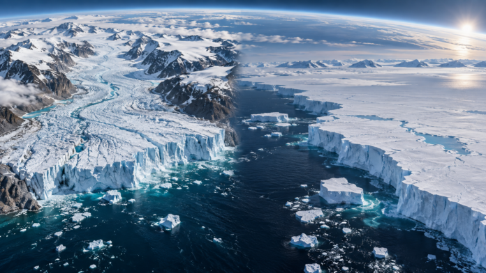
AI-generated editorial illustration | The Press of Asia
What the new study measured
The paper brings together observations from multiple satellite techniques, including measurements of ice-sheet height, gravity and glacier movement. By harmonising different records, researchers aimed to reduce gaps and make long-term comparisons more reliable.
The resulting dataset covers both the mass added through snowfall and the mass lost through surface melting, runoff and the movement of ice into the ocean. The authors reported a contribution to global mean sea level of 31.4 ± 1.6 millimetres over the study period.
This is a global average. Local sea-level change can differ because of ocean circulation, land movement and the gravitational effects of large ice sheets. Even so, the worldwide figure matters because it raises the baseline for coastal flooding, storm surges and erosion.
Why the oceans are central to the loss
According to the AP’s account of the research, about five-sixths of the combined ice loss came from dynamic changes in which glaciers flowed faster toward the sea, largely because warmer ocean water affected them from below or along their edges. The remaining share was associated with changes at the ice-sheet surface, including melting and snowfall.
This distinction explains why a cold year or heavy snowfall in one region does not necessarily reverse the long-term trend. Ice sheets interact with both the atmosphere and the ocean, and some of the fastest changes occur where grounded ice meets seawater.
West Antarctica is a particular concern because parts of its bed lie below sea level, allowing ocean heat to reach vulnerable glacier fronts. The study reported that ice discharge from West Antarctica rose from about 29 ± 7 gigatons per year in the 1980s to 163 ± 12 gigatons per year in the 2010s.
What is happening in Greenland and East Antarctica?
Greenland has experienced large losses from both surface melting and faster glacier flow. Warmer air can increase summer melt, while changes at marine-terminating glaciers accelerate the transfer of ice to the ocean. Variability from year to year remains high, but the long-term balance is negative.
East Antarctica presents a more complex picture. The study identified recent mass gains linked to increased snowfall in parts of the region. Those gains are scientifically important and show why researchers track individual basins rather than treating Antarctica as a single uniform block.
However, the snowfall increase in East Antarctica did not offset the combined losses from West Antarctica, the Antarctic Peninsula and Greenland. Reporting the gain alongside the losses is essential because it prevents a misleading all-or-nothing description of polar change.
What 3.1 centimetres means for people
A few centimetres may sound small compared with the height of a seawall, but sea-level rise shifts the starting point for every high tide and storm surge. Flooding that once required an unusually strong storm can become more frequent when the average ocean level is higher.
The lead author told the AP that each centimetre of global sea-level rise can expose roughly two to three million additional people to annual flooding. That estimate depends on population, protection and local geography, but it illustrates why incremental rise has large consequences.
Asia is especially exposed because it contains densely populated deltas, rapidly growing coastal cities and small island communities. The risk is not limited to permanent inundation. Saltwater can enter groundwater and agricultural land, ports can face higher disruption costs, and extreme rainfall can drain less effectively when coastal water levels are elevated.
How this relates to extreme events
Ice-sheet loss does not cause an individual flood, landslide or storm by itself. Extreme events emerge from multiple factors including weather, terrain, infrastructure and land use. Climate change can alter the background conditions, but responsible reporting must separate long-term trends from the direct cause of a single disaster.
For a related example of how climate, geography and information gaps shape risk in the Himalayan region, read The Press of Asia’s analysis of the Nepal-Tibet flood and transparency questions.
Why the dataset matters
The new work is valuable not because it eliminates uncertainty, but because it states uncertainty and combines multiple lines of evidence. A consistent record helps climate scientists test models, helps governments update coastal-risk assessments and gives researchers a common baseline for future observations.
The study was produced through the Ice Sheet Mass Balance Inter-comparison Exercise, or IMBIE, a collaboration involving international research teams and supported by the European Space Agency. The dataset is openly published, allowing other scientists to examine the methods and use the record in further research.
What happens next?
Researchers will extend the series as new satellite data arrive and will focus on regions where ocean-driven retreat could accelerate. The next questions include how quickly vulnerable glaciers respond to warmer water, how snowfall patterns change and how much ice loss is already locked in by past warming.
For policymakers, the findings reinforce two parallel tasks: reduce the greenhouse-gas emissions that drive long-term warming and adapt coastlines to sea-level rise that is already occurring. The study does not predict a single future number, but it provides a clearer historical foundation for those decisions.