
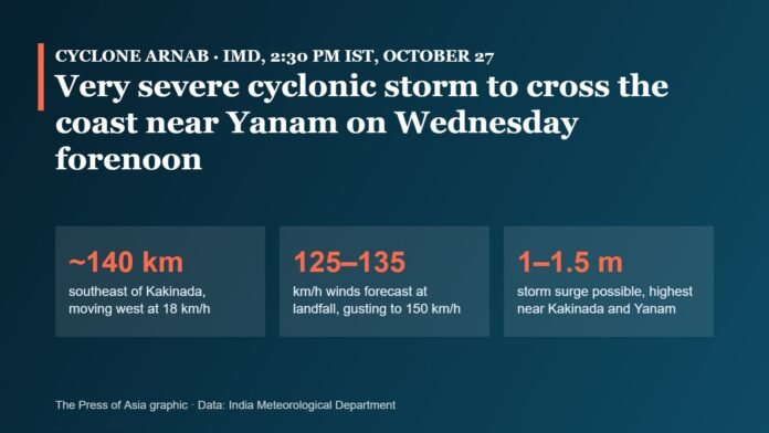
AMARAVATI, October 27: Very severe cyclonic storm Arnab was about 140 km southeast of Kakinada on Tuesday afternoon and is expected to cross the Andhra Pradesh–Yanam coast between Bapatla and Visakhapatnam, close to Yanam, in the forenoon of Wednesday, October 28, the India Meteorological Department (IMD) said. Coastal Andhra Pradesh and south Odisha are under a red alert, and both states have opened thousands of shelters, closed schools and moved people out of low-lying areas.
Key highlights
- IMD’s 2:30 pm bulletin placed Arnab about 140 km southeast of Kakinada and about 170 km from Visakhapatnam, moving west at 18 km/h.
- Landfall is expected in the forenoon of October 28 near Yanam, with sustained winds of 125–135 km/h gusting to 150 km/h.
- IMD Director General Mrutyunjay Mohapatra warned of a storm surge of 1–1.5 metres above normal tide, highest around Kakinada and Yanam.
- Red alerts cover coastal Andhra Pradesh, six south Odisha districts and four Telangana districts for Wednesday.
- Andhra Pradesh says it sent cyclone alerts to 2.70 crore people in 18 districts and readied 2,131 cyclone shelters.
Where the storm is and what IMD expects
| Item | IMD position (October 27) |
|---|---|
| Category | Very severe cyclonic storm |
| Position at 2:30 pm IST | About 140 km SE of Kakinada; about 170 km from Visakhapatnam; 230 km E of Machilipatnam; 380 km SSW of Gopalpur |
| Movement | West, at about 18 km/h over the previous six hours |
| Landfall | Forenoon of Wednesday, October 28, between Bapatla and Visakhapatnam, close to Yanam |
| Winds at landfall | 125–135 km/h, gusting to 150 km/h |
| Storm surge | 1–1.5 m above normal tide, highest in the Kakinada–Yanam (East Godavari) area |
| After landfall | Weakening to a deep depression on October 29 and a depression on October 30 |
Earlier on Tuesday, Mohapatra said the storm was still intensifying over the Bay of Bengal. IMD warned of extensive damage to thatched houses, power and communication lines and standing crops, especially paddy, near the landfall zone, along with disruption to rail, road and air traffic.
How the forecast changed through the day
| IMD bulletin | Distance from Visakhapatnam | Speed of movement | Forecast winds at landfall |
|---|---|---|---|
| 5:30 am IST | About 260 km SE | 22 km/h | 115–125 km/h, gusting to 140 |
| 2:30 pm IST | About 170 km | 18 km/h | 125–135 km/h, gusting to 150 |
Alerts by state
- Andhra Pradesh: red alert across coastal districts. The state disaster management authority (APSDMA) said 1,351 pregnant women had been moved to hospitals and more than 30,000 fishing boats secured. Schools in coastal districts are closed and fishing is suspended.
- Odisha: red alert for Ganjam, Gajapati, Rayagada, Koraput, Malkangiri and Nabarangpur. Special Relief Commissioner Rajesh Patil said at least 48,000 people would be moved from low-lying and landslide-prone areas, about 11,000 each from Gajapati and Nabarangpur. The state has set up more than 1,735 shelters and released ₹19 crore for relief.
- Telangana: red alert on October 28 for Khammam, Bhadradri Kothagudem, Mulugu and Mahabubabad, with heavy rain expected in Warangal, Hanumakonda, Suryapet and Nalgonda on October 28–29.
- Further inland: the National Crisis Management Committee was told on October 26 that the system could also affect south and central Chhattisgarh, east Uttar Pradesh and Bihar as it weakens.
Rescue teams, shelters and transport
Cabinet Secretary T. V. Somanathan, chairing the National Crisis Management Committee on October 26, asked all agencies to work towards zero loss of life. The National Disaster Response Force said on Tuesday morning that 25 of the 31 teams requisitioned had been deployed and five more were on the way. In Visakhapatnam, municipal commissioner Ketan Garg said residents of about 122 low-lying areas were being moved to 57 relief centres.
Railways Minister Ashwini Vaishnaw said about 600 km of track was under close watch and relief wagons were stationed at six locations. South Coast Railway cancelled more than 70 services on October 27 and 28, and other zones cancelled, diverted or short-terminated further trains. Passengers should check train status on the National Train Enquiry System or by calling 139 before travelling. Some flights at Vijayawada’s Gannavaram airport have been disrupted, and airlines have warned of possible disruption at Visakhapatnam.
Our calculation
- Stronger at landfall than first forecast: between the 5:30 am and 2:30 pm bulletins, IMD raised its landfall wind forecast by 10 km/h, to 125–135 km/h, and gusts from 140 to 150 km/h.
- Reach of the alerts: 2.70 crore people alerted in Andhra Pradesh is more than half of the state’s 2011 Census population of about 4.94 crore.
- Shelter capacity: with 2,131 shelters in Andhra Pradesh and more than 1,735 in Odisha, the two states have readied over 3,800 shelters between them.
Helplines
- Andhra Pradesh state control room: 112, 1070 and 1800 425 0101.
- Greater Visakhapatnam Municipal Corporation: 1800 425 0009.
- Railway enquiries: 139.
What it means
Arnab is the second storm in two years to aim at the Kakinada–Yanam stretch of the coast, and the forecast has moved towards a stronger landfall through the day. The biggest risks are the surge in the low-lying Godavari delta, extremely heavy rain in coastal Andhra Pradesh and south Odisha, and flooding in the hill districts of Odisha and Telangana as the system moves inland. Across the border, Nepal’s National Disaster Risk Reduction and Management Authority has put the country on high alert for October 29–31 for rain from the storm’s remnants.
What to watch
- The exact time and point of landfall on Wednesday forenoon, and IMD’s hourly updates as the storm nears the coast.
- Rainfall totals in the Godavari delta, Visakhapatnam and the south Odisha hill districts.
- Train cancellations and diversions, some of which run until November 5.
- Crop damage assessments in paddy-growing districts once the storm passes.
Our earlier report: Cyclone Arnab forms: IMD forecasts Andhra–Yanam landfall on October 28.
Graphic: The Press of Asia, using India Meteorological Department figures from its 2:30 pm IST bulletin on October 27, 2026.
Sources
- Press Information Bureau: Cabinet Secretary chairs NCMC meeting to review preparedness for the impending cyclone in the Bay of Bengal (October 26, 2026)
- India Meteorological Department
- National Disaster Management Authority: Cyclone do’s and don’ts
- Indian Railways: National Train Enquiry System

The National Desk covers India's politics, governance, security and public-interest news. Stories are checked against at least two credible sources before publication.