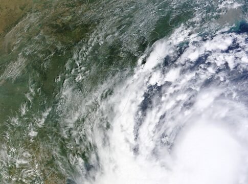
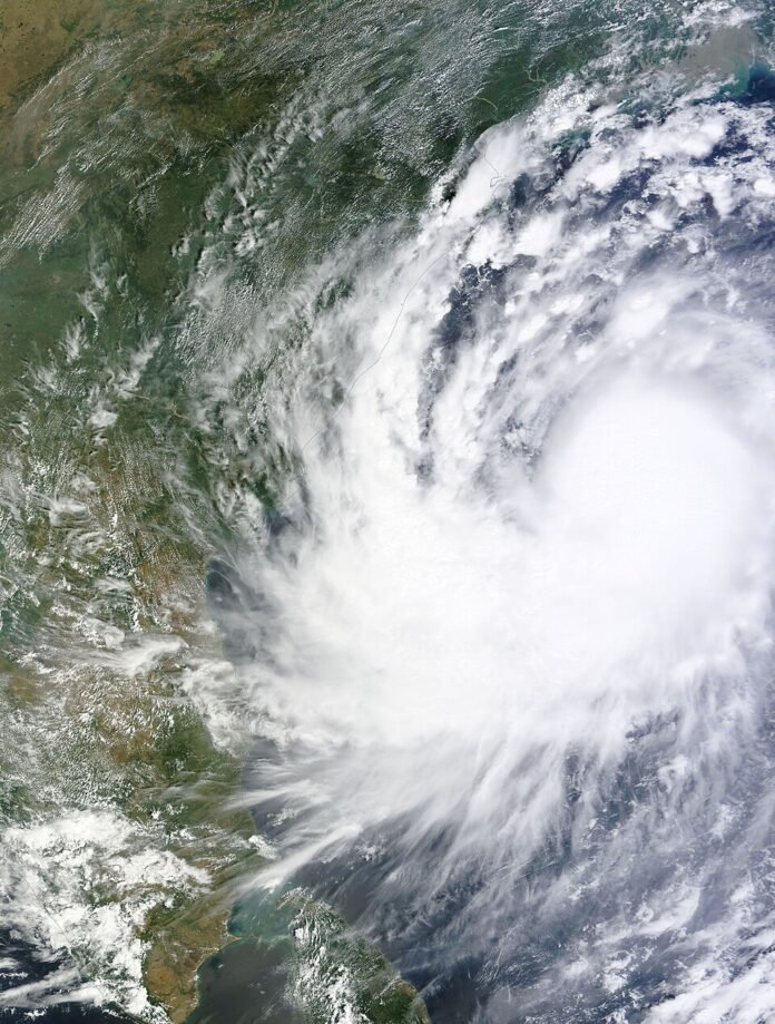
November 20: Cyclonic Storm Akvan crossed the north Andhra Pradesh and south Odisha coast close to Gopalpur between 7:30 a.m. and 8:30 a.m. IST on November 20, according to the India Meteorological Department. The morning update put sustained winds at 70–80 kmph, gusting to 90 kmph. Residents should continue to follow local instructions rather than treat the coastal crossing as an all-clear.
Key highlights
- IMD placed the coastal crossing near Gopalpur during 7:30–8:30 a.m. IST on November 20.
- The reported sustained wind speed was 70–80 kmph, with gusts reaching 90 kmph.
- The system had weakened from a severe cyclonic storm into a cyclonic storm earlier in the morning.
- The confirmed crossing replaces earlier forecasts; it is not a verified assessment of damage or casualties.
What IMD has confirmed
IMD’s 9:30 a.m. hourly bulletin identifies the crossing close to latitude 19.1°N and longitude 84.8°E. It says the landfall process was still continuing at the bulletin’s issue time. That is a time-specific observation: an earlier statement that the process would last another hour should not be repeated later as though it were a fresh forecast.
The overnight change is also important. The department’s bulletin based on observations at 2:30 a.m. recorded a weakening from a severe cyclonic storm to a cyclonic storm over the westcentral Bay of Bengal. By the morning, the main news was the confirmed coastal crossing rather than whether landfall would happen.
Why older forecasts now show different numbers
Earlier forecasts described the storm before its final approach and included higher possible wind speeds. Those predictions should not be mixed with the subsequently reported crossing intensity. A forecast gives the expected future state of the system; a later observation updates what meteorologists have assessed.
For readers following alerts through forwarded messages, the issue time is as important as the headline. A screenshot can be genuine and still describe an earlier stage of the same storm. Check the bulletin’s date, observation time, location and named districts together before using it to make a travel or safety decision.
Landfall is not a damage assessment
Our analysis: the reported wind speed tells readers about the storm’s intensity at a particular point in its development. It does not establish the condition of every road, electricity line, building or coastal settlement. Local flooding and access restrictions require separate information from district administrations and emergency services.
This report does not give a casualty total or a financial-loss estimate because neither is established by the meteorological sources cited here. Similarly, the coast-crossing announcement alone cannot establish that transport has resumed, schools have reopened or evacuated residents have been cleared to return. Those are separate decisions and should be checked through the responsible authorities.
What residents should do next
The National Disaster Management Authority’s SACHET guidance advises people to rely on official warnings, avoid rumours and stay away from damaged buildings. It also tells those facing flooding or storm-surge warnings to know the nearest safe high ground or shelter and the safest route to it. Follow the instructions issued for your own area.
A quiet interval is not a substitute for an official all-clear. Keep track of current IMD bulletins and local disaster-management directions, and avoid unnecessary journeys to photograph rough seas or damage. When contacting relatives, share the latest dated official notice rather than an unverified video or an old forecast.
For people outside the affected region, the most useful distinction is between what has been observed and what remains to be assessed. Today’s confirmed development is the crossing near Gopalpur. Any later account of disruption, rescue operations or restoration should identify its location, time and responsible source.
At a glance
| Item | Verified morning information |
| Date | November 20, 2026 |
| Coastal crossing | Near Gopalpur |
| Crossing time | 7:30–8:30 a.m. IST |
| Sustained wind | 70–80 kmph |
| Gusts | Up to 90 kmph |
| Main official references | IMD morning bulletins; NDMA safety guidance |
What to watch
Watch the next IMD bulletins for the system’s inland movement and weakening, and district notices for local restrictions or reopening decisions. The figures above describe the confirmed morning crossing, not a claim that every hazard has ended. Later damage and casualty information should be added only when separately verified.
Sources
- IMD: Hourly bulletin, November 20, 9:30 a.m. IST
- IMD: National bulletin based on November 20, 2:30 a.m. observations
- NDMA SACHET: Disaster do’s and don’ts

The National Desk covers India's politics, governance, security and public-interest news. Stories are checked against at least two credible sources before publication.