
October 31: Malaysia’s October 31 national forecast points to afternoon thunderstorms in Kuala Lumpur, Putrajaya and parts of Peninsular Malaysia, with thunderstorm activity also forecast across areas of Sabah and Sarawak. METMalaysia’s day-and-night bulletin shows different conditions by region and time of day. It is a forecast for October 31, rather than confirmation that storms have already occurred at every listed location.
Key highlights
- Afternoon thunderstorms are forecast in parts of Kuala Lumpur and Putrajaya.
- The forecast also covers inland areas of several Peninsular states.
- Sabah and Sarawak have their own afternoon and night-time patterns.
- A daily forecast should be checked alongside the latest short-term warnings.
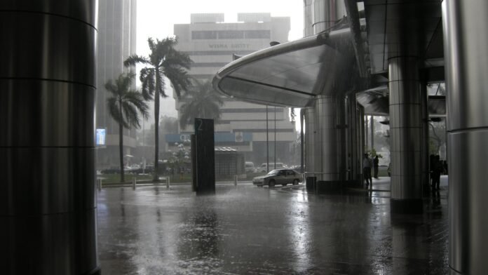
File photo: tropical rain at KLCC in Kuala Lumpur (March 25, 2008). Photo: Vyacheslav Argenberg / Wikimedia Commons, CC BY 4.0. Cropped and resized; the adapted image retains the stated licence. Not a photograph of the October 2026 event or current conditions.
Where afternoon storms are forecast
METMalaysia lists scattered afternoon thunderstorms for Pahang, Johor, Kuala Lumpur and Putrajaya, alongside inland parts of states including Perak, Selangor, Kedah, Penang and Negeri Sembilan. In Sabah, it forecasts thunderstorms in many parts of the Interior and West Coast divisions, and in some parts of Sandakan.
For Sarawak, the bulletin lists afternoon thunderstorms in parts of divisions including Kuching, Samarahan, Serian, Sri Aman, Betong, Sibu, Bintulu, Miri and Limbang. These are area forecasts: a listed division need not experience the same conditions at every point or for the entire afternoon.
At a glance
| Location | Afternoon outlook | Night outlook |
|---|---|---|
| Kuala Lumpur / Putrajaya | Thunderstorms in some places | No rain forecast |
| Inland Kelantan / Terengganu / Pahang | Check state-area forecast | Thunderstorms in some places |
| Sabah Interior / West Coast | Thunderstorms in many places | Rain in some places |
| Labuan | Rain in many places | Rain in many places |
The evening picture is different
The same bulletin forecasts night-time thunderstorms in inland Kelantan, Terengganu and Pahang, and rain in parts of several other Peninsular states. Kuala Lumpur, Putrajaya, Johor and Melaka are listed without rain at night. Sabah and Labuan retain separate rain forecasts, as do parts of Sarawak.
Kuala Lumpur’s daily panel gives a maximum temperature of 34°C and a minimum of 23°C. These values describe the day’s temperature outlook; they are not the temperature at the moment a reader opens this article.
A dry night-time forecast does not cancel an afternoon storm outlook. Equally, a forecast of storms in some locations should not be turned into a claim that an entire state is under continuous severe weather. Timing and geographic wording are essential parts of the information.
How to use the forecast for travel
For a person planning an outdoor afternoon appointment, the practical value is to build in flexibility: check the latest warning before departure, identify an indoor alternative and allow for local disruption if a storm develops. A forecast does not establish that a particular road is flooded, a flight is cancelled or a school has closed.
Travellers crossing between Peninsular Malaysia, Sabah and Sarawak should use the relevant regional forecast, rather than relying only on Kuala Lumpur’s panel. Conditions can differ substantially between the destination and the departure city, and a national headline cannot replace those local details.
Short-term alerts can also change after the daily bulletin is issued. Readers should check the official warning service and local transport announcements for an immediate journey. A screenshot without its issue time or validity period may no longer describe the current situation.
Forecast, warning and reported impact
These are three different levels of information. A forecast describes expected conditions; a warning identifies a defined weather risk and validity period; a report of impact records what has actually happened. This article summarises the October 31 forecast and does not claim observed flooding, injuries or a nationwide emergency.
The distinction is particularly important when old alerts circulate during a wet spell. A notice that expired earlier in the day should not be presented as a current warning simply because thunderstorms remain possible later. Check the date, local time, affected area and expiry before sharing an alert.
All times and day periods here refer to Malaysia. The photograph is an archival view of rain in Kuala Lumpur, clearly credited below; it does not show October 31 conditions. The official bulletin remains the source for the day’s regional outlook.
Sources
- METMalaysia: National weather forecast for October 31, 2026
- METMalaysia: Official forecasts and current warnings

The International Desk covers world and Asian affairs, diplomacy and conflict, with a focus on what they mean for India. Stories are checked against at least two credible sources before publication.