November 2: The Thai Meteorological Department has warned of unsettled weather in upper Thailand during November 5–7, followed by increased rain and locally very heavy falls in the South during November 7–9. Its Thai-language Advisory No. 3, issued at 5pm on November 2, includes thunderstorms, gusty winds and hail in parts of the upper country. This is a forecast warning for the coming days, not a report that every listed area is already flooded.
Key highlights
- Upper Thailand faces a November 5–7 period of thunderstorms, gusts and locally heavy rain.
- The Northeast is expected to be affected first, with other upper regions following.
- Southern rain is forecast to increase during November 7–9.
- Travellers should check current local notices rather than assume a nationwide closure.
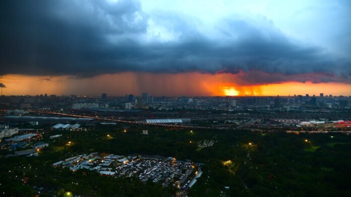
File photo: Rain over Bangkok, Thailand (June 2, 2018). Credit: Trisorn Triboon / Wikimedia Commons, CC BY-SA 4.0. Cropped and resized by The Press of Asia; adapted photograph licensed under CC BY-SA 4.0. Archival weather photograph; it does not show the forecast November 2026 conditions.
Two phases, rather than one nationwide event
The department’s evening advisory places the Northeast first in the upper-country sequence. The North, Central region, Bangkok and its surrounding area, and the East follow. Its southern warning concerns accumulated rainfall and the possibility of flash flooding and runoff, particularly near foothills, waterways and low-lying ground.
The English-language morning advisory, No. 2, describes the same broad November 5–9 sequence. It also warns that waves in the Andaman Sea and Gulf of Thailand can exceed two metres in thunderstorms, and advises vessels to avoid thunderstorm areas. The evening Thai notice is the later bulletin used for the upper-country storm description here.
At a glance
| Period or issue | Official warning | Practical distinction |
|---|---|---|
| November 5–7 | Thunderstorms and gusts in upper Thailand | Northeast first, other upper regions later |
| November 7–9 | Heavier rain in the South | Accumulation can raise flood and runoff risks |
| Marine conditions | Waves above two metres in thunderstorms in the morning advisory | A storm-area forecast, not a uniform wave height everywhere |
| Reference bulletin | No. 3, November 2 at 17:00 Thai time | Check for subsequent revisions before travel |
What is driving the change
TMD attributes the change to another high-pressure system from China extending across upper Thailand and the South China Sea, strengthening the easterly flow over Thailand and the Gulf. The resulting warning concerns a changing weather pattern over several days.
A forecast period is not an exact appointment for a storm at a particular hotel, road or beach. Conditions can vary sharply between nearby locations, and the bulletin does not provide a verified closure list for every ferry, airport or railway. Any cancellation should be checked with the operator or local authority responsible for that service.
How travellers should read the warning
The most useful first step is to identify the province and the day of travel, then compare them with the relevant part of the forecast. A journey to Bangkok early in the period and a coastal trip in the South later in the week face different planning questions. One national headline cannot answer both.
For a trip involving an island or a boat transfer, the marine notice and the operator’s current instructions matter alongside the forecast for the town on land. A hotel booking or an unchanged airline reservation is not confirmation that a particular boat crossing will operate. Ask the operator about the specific route and departure.
For an overland journey, travellers should consult current route and local disaster notices. A weather warning identifies a risk; a road-closure notice identifies an actual restriction. Keeping those records separate avoids both unnecessary alarm and the opposite mistake of treating an absence of a closure notice as proof that conditions cannot change.
Why accumulated rain matters
Flood risk is not determined only by the rain falling at the moment someone looks outside. Water can collect over time or arrive from higher ground and upstream catchments. This is why the official bulletin highlights foothills, waterways and lowlands, rather than presenting one rainfall threshold as a universal measure of safety.
The department advises people in upper Thailand to avoid exposed outdoor locations, large trees and unsecured billboards during severe weather. Its warning should be understood as precautionary advice for the forecast conditions. This article does not establish that a particular building, campsite or route has been inspected or declared safe.
Readers should also check the date on weather images circulated online. A dramatic photograph of an earlier flood cannot establish the conditions on November 2 or predict the exact impact next week. The photograph accompanying this article is expressly dated as an archival Bangkok rain image.
What to watch
The evening advisory schedules the next bulletin for 5am on November 3, Thai time. Later notices may alter the affected areas, timing or severity. Use TMD’s current warning page and the relevant transport or local-authority notice when making a time-sensitive decision.
The confirmed development is an advance official warning covering different regions at different times. Reports of actual flooding, damage or disrupted services would require separate verification; no casualty figure or nationwide shutdown is asserted here.
Sources
- Thai Meteorological Department: Current Thai-language storm advisories, including No. 3 of November 2
- Thai Meteorological Department: English Advisory No. 2, November 2
- Thailand Department of Local Administration: Local disaster alerts

The International Desk covers world and Asian affairs, diplomacy and conflict, with a focus on what they mean for India. Stories are checked against at least two credible sources before publication.